Now, that data is being used to predict what parts of cities feel the safest. StreetScore, a collaboration between the MIT Media Lab’s Macro Connections and Camera Culture groups, uses an algorithm to create a super high-resolution map of urban perceptions. The algorithmically generated data could one day be used to research the connection between urban perception and crime, as well as informing urban design decisions.
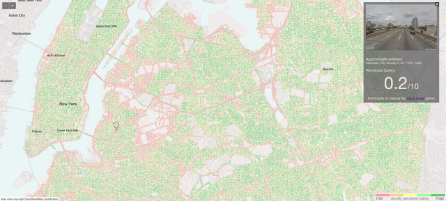
The algorithm, created by Nikhil Naik, a Ph.D. student in the Camera Culture lab, breaks an image down into its composite features—such as building texture, colors, and shapes. Based on how Place Pulse volunteers rated similar features, the algorithm assigns the streetscape a perceived safety score between 1 and 10. These scores are visualized as geographic points on a map, designed by MIT rising sophomore Jade Philipoom. Each image available from Google Maps in the two cities are represented by a colored dot: red for the locations that the algorithm tags as unsafe, and dark green for those that appear safest. The site, now limited to New York and Boston, will be expanded to feature Chicago and Detroit later this month, and eventually, with data collected from a new version of Place Pulse, will feature dozens of cities around the world….(More)”